Depart North Carolina for MN for a wedding anniversary celebration for Joseph's grandparents. From that point, we boarded our plane for a direct flight to Anchorage. Lucky for us, we were traveling against the sun, gaining more time as we flew, heading northbound over the pock-marked landscape of Canada, stunning wetlands glimmering up at us. We noted that you could clearly see that path that the ancient glaciers traversed, embedding distinct scarring into the land.

Outside of Anchorage is the area called Turnagain Arm, with the world's largest tidal zone. Here they have the mud flats, which pose a serious threat to any nieve tourist or native. It acts like quicksand, making it difficult to escape. It happens often enough that the local fire department has a special truck and protocol for rescuing anyone caught in this awful trap. To free the person, they force water into the sand, helping to "float" the person up and out of the muck. The sign below mentions something of the tidal zone, however, you can see that this sign (and many others) have become part of target practice.


Our ride was a sweet one! We asked for a compact car, and we definitely got what we asked for. It even has racing stripes across the top. I am guessing that we averaged about 40 mpg for the entire trip. We had to wait in line to enter a one-way tunnel that is shared with the train. It only goes to the town of Whittier. Here is where we depart for our glacier cruise into Prince William Sound.
 Begin the cruise! Tons of gorgeous waterfalls cascading down the mountainsides as the glaciers melt above. And, yes, the water is really that shade of blue-green (it's also about 40 degrees in temp - don't fall in!).
 Our first large glacier. Here we are about one mile away from the face which towers over 600 feet. This was the most active glacier that we saw.
 Here you can see the entire face of the glacier crashing into the water. It was the largest calving that the tour company has seen. It created a surge of water probably 8 feet high, threatening to topple over our cruise boat. We high-tailed it out of there, some people seeing visions of the fate of the Titanic. It was breath-taking.
 Moose! Unfortunately, this one is in a wildlife refuge, but it looks like a National Geographic photo (sort-of!).


Here is where you can see evidence of the 1964 earthquake that shook Alaska. The dead trees that you see in the foreground sunk, allowing salt water into their roots which killed them. In a few places, the ground sunk up to 8 feet.
The day after our glacier cruise we decided to take an impromptu trip down to Seward. It wasn't part of our original itinerary, but so many people said to go there so we jumped on board a wildlife cruise. Here are some the creatures we saw....
 Sea Lions...
 Humpback whales breaching....
 Sleeping humpback whale
 Bird rookery (bird habitat where they create a hierarchy, closest to the water being the lowest rank)...
It was a wonderful day, although while we were in pursuit of the breaching whales we happened upon some rough waters, whitecaps, and rain. It was a trying time for those lacking iron stomachs.
After departing Seward, staying only for the afternoon, we continued on through the stunning Kenai Peninsula. It is known as "bear country." Constantly, Joseph and I were searching on road sides, along mountain tops, on river banks for any sign of bear activity, but found nothing. I guess brown bears don't frequent highways. What a surprise. This ain't Yellowstone, baby!
Our destination was the southern-most point in Alaska reachable by vehicle: Homer. The drive in felt like the drive up to Duluth, MN for anyone that has done it. Taking Hwy. 35 N, the hills climb around you, the temperature drops, and you finally cross around the belly of the mountain anticipating the explosion of hustle and bustle, people and buildings, cars, the smell of the water, the lights, the trees, the sun setting on the Lake; feels like home. This is what it was like to arrive in Homer. Stopping at a scenic stop on the side of the road, Joseph and I both remarked that this place felt familiar, like home. Too bad we were thousands of miles from it. Or were we? Who knows. Maybe in another life.
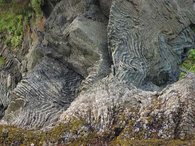
Day 2 in Homer involved a half-day kayak trip, including lunch. During our trip, we encountered elephant kelp, puffins, sea otters, and other interesting sea life as well as some fantastic rock formations (seen below). Our lunch included some sea lettuce and kelp (I know it sounds weird, but it was truly delectable). Apparently, you could eat a sea star if you were that hungry. I think it would taste like salt-water taffy, but with prickles.
On the Homer "spit," which is the 4-mile long peninsula out into Kachemak Bay, there are all sorts of businesses: art dealers, wood carvers, fishing and kayaking charters, and the most fantastical seafood you could ever indulge in. The scallops were buttery and soft, the crab was to die for, smoked salmon from heaven (or from that river just behind you). Here was a common sight: an employee of the charter cleaning that days catch made by the tourists on board.


Look what I found, mom! Joseph went out on his own charter while I wandered around town and investigated the art galleries, local food coop and craft stores. He caught about 30 pounds of fish. We had this Halibut professionally cleaned and package, sent via airmail to North Carolina. Now, we have 8 pounds Halibut (try it in a Ginger Teriyaki marinade and you will just melt) and another 5 pounds of regular and smoked Salmon to indulge in until our next trip. Yum!
Eagles were an all-too-common sighting in Homer, with over 60 living on or near the "spit." They became as regular as the sea gulls.


Homer was our "home away from home away from home." It truly was magical.
From Homer, we continued our way back up through the north, stopping for a night in Palmer (the neighbor town to Wasilla - famed hometown of a now famous former mayor, Sarah Palin). Palmer felt like we were in "Farmtown," USA; there were grazing cows, pastures, massive vegetable crops (midnight sun helps out a lot when aiming for 1 ton pumpkins!), and an upcoming county fair complete with tractor pull.
Here, we masqueraded around on horseback for a few hours in the woods, all the while having to continue conversation, although sometimes superficial, in order to warn the bears that we were riding through their country. Never have I felt more vulnerable and humbled in nature, no longer feeling as though I am the dominant animal (although, we were ever?).
Next stop....Denali!
I wish I had our videos up right now to show you the expanse of this mountain. It is truly fantastic. We were one of the lucky ones to see it; only 20 days out of the tourist season typically are clear enough to have Denali visible. This mountain is so large that it creates its own weather systems, making it equally difficult to see.
We opted for a bus tour into the National Park. No cars are allowed within the park, with only one dirt road (2 lanes) traveling 8 hours into the park, then turning around to traverse the same road back. Here we spotted our first momma grizzly with two cubs. Apparently, this time of year the bears are eating mostly bugs and roots pulled from the earth.

Watch out for that moose!
 I will definitely need to add videos in a future blog. We were so overtaken with awe on our adventure that we barely took any photos and pretty much all video. Soon to come!
 I will definitely need to add videos in a future blog. We were so overtaken with awe on our adventure that we barely took any photos and pretty much all video. Soon to come!
Our night was spent in Talkeetna, which is an old gold mining town south of Denali. This is where all the mountain climbers start their climb by boarding a prop plane and flying up to base at 7,000 feet on the side of the mountain. At that point, it takes 2 weeks to climb up, stopping at two more bases before reaching the summit, then 1 week to climb down, which is sometimes the most dangerous part.
In our B&B, we were told by the house-lady (she might have been a little tipsy) that we were staying alone in a house that was haunted. There just happened to be no other renters that night. I barely slept.
The next morning, we awoke to a mildly foggy day ready to board our prop plane for a summit Denali flight. It was intense. Another reason to get videos up on this site. We had to wear oxygen masks because our ascent was so quick and the cabin wasn't pressurized.


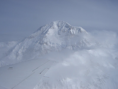
The plane went to 21,000 feet to view the summit of Mt. McKinley (known as Denali in Alaska). We were able to see the camp where all the mountain climbers were resting due to a recent blizzard and sub-zero temps. The pressure in the plane was so great and the elevation was enough to make me ill. Both Joseph and I felt numbness and tingly in our arms and legs, a bit of dizziness, and an icky stomach. But, no casualties! We landed safe and sound, having experienced the summit of Denali minus the frostbitten toes and frozen eyelashes.
To give you a feel for Talkeetna (sort of a hippy-haven), I have included a moose sighting.

On our way out of Talkeetna, heading south to Anchorage, we stopped at an old Russian Orthodox cemetery in Eklutna dating back to 1650. The dead were buried in little dollhouses called "spirit houses." It is still an active cemetery with over 100 "houses" in it. The size of the house is determined by the social status of the individual and the colors correspond to the clan affiliation (this is an area where natives were converted to Russian Orthodox christianity). I really enjoyed it and could have spent hours here, taking photos and analyzing the little houses, very childlike.


 Wrapping up our time in Alaska was bittersweet. As we arrived in Anchorage, cold and rainy, we realized that we were leaving a place that could have been "home." We weren't ready to leave, didn't feel like we should leave, and yet our lives were calling us back to North Carolina. We made some final stops in Anchorage, watching windsurfers in the bay, going for a walk, picking wildflowers (shhh, don't tell anybody, I don't think we were supposed to). We will be back. There is no question.


